Destination guide · 1,627 m
Pithoragarh: the three roads in, and what is there
An open 50 sq km valley at the head of the Kailash Mansarovar Road, reached by three genuinely different roads that nobody bothers to distinguish.
- Local Kumaon routes
- Clear trip guidance
- Driver-led travel
Quick answer
Pithoragarh is roughly 180 to 215 km from Kathgodam and six to eight hours, and which figure applies depends entirely on which of three roads you take. The town sits at 1,627 m in the Saur (Soar) Valley, an open bowl of about 50 sq km — unusual in a region of narrow river valleys, and the reason it is often called a little Kashmir on travel blogs. Route A goes via Almora, roughly 200 to 215 km. Route B via Bhimtal and Dhanachuli is about 178 km and bypasses the Kwarab landslide zone entirely. Route C comes through the plains via Tanakpur, where the station is officially 138 km from Pithoragarh and is the nearest railhead.
The essentials
- Altitude
- 1,627 m
- Setting
- The Saur (Soar) Valley, about 50 sq km
- From Kathgodam
- Roughly 180–215 km depending on route; typically 6–8 hours
- Nearest railhead
- Tanakpur, officially 138 km — considerably closer by road than Kathgodam
- From Nainital
- 218 km (official district figure)
- From Delhi
- 457 km (official district figure)
- From Pantnagar airport
- 241 km (official district figure)
- To Badrinath
- 329 km (official district figure)
- The highway
- NH-9, known in Uttarakhand as the Kailash Mansarovar Road
- Commonly cited attractions
- Pithoragarh Fort and the Chandak viewpoint
Distances and journey times on this page are drawn from published sources and from our own driving, and are given as ranges because that is what they honestly are. A figure quoted to the kilometre on a Himalayan road is usually a figure someone made up.
Three roads in, and why it matters
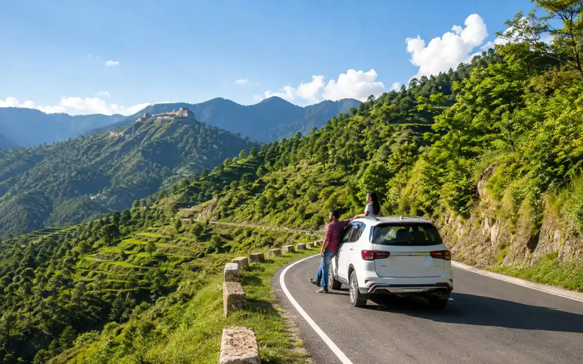
Most sites publish one distance for Pithoragarh and leave it there. That is why the numbers you find online disagree so wildly — they are describing different roads. There are three genuinely different alignments and the right one depends on where you are starting, what the Kwarab stretch is doing, and whether you are coming by train.
| Route | Via | Distance | Why you would take it |
|---|---|---|---|
| A: via Almora | NH-109 to Almora, then NH-309B (Almora–Panar, 82 km), then NH-9 — through Dhaulchhina, Panuwanaula, Danya, Panar and Ghat | ~200–215 km | The classic route, and the one to take if you want to break the journey at Almora or see the Kumaon hill towns on the way. Wikipedia gives 212 km from Kathgodam. |
| B: via Bhimtal and Dhanachuli | Ranibagh, Bhimtal, Dhanachuli, Mornaula and Mirtoli, rejoining at Danya, then Panar and Ghat | ~178 km | The shortest, and it bypasses the Kwarab landslide zone entirely. This is a real operational advantage, not a marketing claim, and it is the route we would default to when Kwarab is in doubt. |
| C: via the plains | Tanakpur, Champawat and Lohaghat on NH-9 | Longer from Kathgodam, but only 138 km from Tanakpur station | The route that changes your train booking. If you can get to Tanakpur by rail, the road leg is roughly a third shorter than from Kathgodam. |
The Tanakpur point, which almost nobody makes. Tanakpur railway station is officially 138 km from Pithoragarh and is the nearest railhead to the town. Kathgodam is the famous railhead for Kumaon, and for Nainital, Bhimtal, Kainchi Dham, Almora and Ranikhet it is unquestionably the right one. For Pithoragarh it is not obviously the best choice at all. If your train can reach Tanakpur, you cut a large amount of hill road out of the journey, on a route that runs through Champawat and Lohaghat on NH-9.
We are a Kathgodam operator, so telling you this costs us kilometres. We would still rather you knew before you booked the train than after.
Route A carries the Kwarab risk; Route B does not. The Kwarab stretch on NH-109, between Khairna and Almora, has been closed repeatedly since a 2024 landslide. By September 2025 there were reported cracks in the new bridge, splitting retaining walls and a sunk carriageway; heavy vehicles were banned for more than twenty days and traffic was diverted through Ranikhet. It closed again from 29 May 2026 until further orders, with official diversions via the Kwarab bypass for light vehicles and buses and via Almora–Vishwanath–Shahrafatak or Khairna–Ranikhet for heavy vehicles.
We will not state whether it is open on the day you are reading this. What we will say is that the Bhimtal–Dhanachuli alignment avoids the zone altogether, which is the main reason it exists on this page. Ask about the current position when you book and check locally on the morning. The full history is on the Almora route page.
The Saur Valley, and the nickname
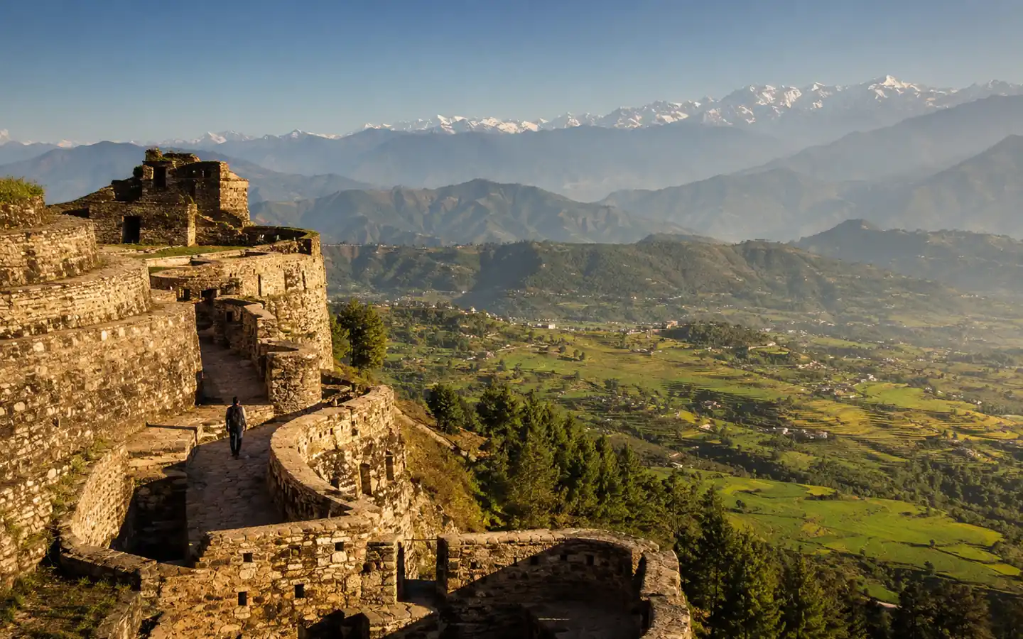
Pithoragarh sits at 1,627 m in the Saur (Soar) Valley, an open valley of about 50 square kilometres. That number is the interesting part. Most of Kumaon east of Almora is narrow river gorge; a fifty-square-kilometre bowl with a town in the middle of it is a genuinely different landscape, and it is why the approach into Pithoragarh feels unlike the rest of the drive.
About “Little Kashmir”. You will see Pithoragarh described as the Little Kashmir of Uttarakhand almost everywhere. We can tell you where the nickname comes from — the open, broad valley floor ringed by hills, which reminds visitors of Kashmiri valley country rather than of a Himalayan gorge — and that it is widely used on travel blogs and in tourism writing. We can also tell you that we could not find it on the district administration’s own site or on Wikipedia. So: often called, not officially called. We would rather flag that distinction than repeat a phrase as fact because everyone else does.
Commonly cited attractions in and around the town are Pithoragarh Fort and the Chandak viewpoint. We are deliberately not publishing opening hours, ticket details or view claims for either, because we have not verified them from a source we would stand behind. Ask locally, or ask your driver, who will know this week’s answer rather than last year’s.
Pithoragarh as a district headquarters
The practical identity of Pithoragarh is administrative, and this matters more than the sightseeing if you are heading further east. It is the headquarters of Pithoragarh district, which is the district that contains Dharchula, the Vyas Valley and the whole Adi Kailash and Om Parvat route. NH-9 through here is the Kailash Mansarovar Road — the alignment that continues through Askot towards the border country.
That means Pithoragarh is where the administration of that route lives: the district disaster management control room, the district magistrate’s office, and the machinery that decides whether Inner Line Permits are being issued and whether the road above Tawaghat is open. If your trip has Adi Kailash in it, this town is not a stopover, it is the place the decisions about your trip are made. The permit guide and the dated road status page set out who issues what.
For most travellers, Pithoragarh works as an overnight break on the way to Dharchula, which is about 90 km further north at around 940 m on the Mahakali river. Six to eight hours up from Kathgodam and then a shorter run the next day is a far better trip than nine to eleven hours in one go.
Monsoon on this corridor
Mid-June to mid-September brings heavy daily rain to Pithoragarh, with landslide risk across the corridor. This is not the lower lakes, where monsoon mostly means a wet afternoon. All three routes in cross long stretches of hill road where a slide closes the only alignment available, and the roads north of the town — towards Dharchula, Jauljibi and Tawaghat — are more exposed still.
If you are travelling here between late June and September, read our monsoon travel guide, build slack into the itinerary, and do not plan a tight connection out of the hills. The Pithoragarh District Disaster Management control room can be reached on 05964-226326 and 05964-228050, and the national disaster helpline is 1077.
When to go
The pattern is the standard eastern-Kumaon one. March to mid-June and October to November are the reliable windows, with October giving the clearest long views after the rain has cleared the air. Mid-June to mid-September is the monsoon and is the season to avoid on this corridor unless you have a reason and a flexible itinerary. Winter here is cold but the town itself, at 1,627 m, is far less snow-affected than Munsiyari or the passes further north.
Planning the drive
Six to eight hours is a full day and should be treated as one. Our advice, in order of how often it changes people’s plans:
- Check whether Tanakpur works for your train. 138 km instead of 180 to 215 is a materially better day.
- Ask which alignment your driver intends to use, and why. A driver who has a view on Route A versus Route B knows what the road is doing. One who does not, does not.
- Take an SUV. Six to eight hours with long single-lane sections is not a hatchback day, and the fleet page explains what each vehicle takes.
- Break the journey if you are going further. Pithoragarh to Dharchula the next morning is a much better trip than Kathgodam to Dharchula in one push.
The route detail, including how the two Kathgodam alignments compare kilometre by kilometre, is on the Kathgodam to Pithoragarh route page, and the fare guide explains why a one-way drop on a route this long costs close to a return.
Ask us which road we would take
Tell us your date, where you are arriving and whether you are going further east. We will tell you which alignment we would use, what we last heard about the road, and whether Tanakpur would be a better railhead for you than Kathgodam.
Common questions
How far is Pithoragarh from Kathgodam?
Roughly 180 to 215 km, typically six to eight hours, and the figure depends on the route. Via Almora it is about 200 to 215 km; via Bhimtal and Dhanachuli about 178 km. Wikipedia gives 212 km for the Almora alignment.
What is the nearest railway station to Pithoragarh?
Tanakpur, officially 138 km away. Kathgodam is the better-known Kumaon railhead but is further by road from Pithoragarh. If your train can reach Tanakpur, the road leg is considerably shorter.
Which route to Pithoragarh avoids the Kwarab landslide?
The Bhimtal and Dhanachuli alignment — Ranibagh, Bhimtal, Dhanachuli, Mornaula and Mirtoli, rejoining at Danya. It bypasses the Kwarab zone entirely, which matters because that stretch on NH-109 has been closed repeatedly since 2024.
Is Pithoragarh really called Little Kashmir?
It is often called that, on travel blogs and in tourism writing, because of the open valley floor ringed by hills. We could not find the nickname on the district administration’s own site or on Wikipedia, so we report it as a popular description rather than an official one.
What is the Saur Valley?
The valley Pithoragarh sits in, about 50 square kilometres, also written Soar. It is unusual for eastern Kumaon, where most settlements sit in narrow river gorges, and it is what gives the approach into the town its open character.
What is NH-9 in Uttarakhand?
NH-9 runs through Tanakpur, Champawat, Pithoragarh and Askot, and in Uttarakhand it is known as the Kailash Mansarovar Road. It is the alignment that continues towards the border country and the Vyas Valley.
Is Pithoragarh a good base for Adi Kailash?
It is the district headquarters for the whole Adi Kailash and Om Parvat route, and where the permit and road decisions are made. Most travellers use it as an overnight break on the way to Dharchula, which is about 90 km further north. See our Adi Kailash section for permits and dated road status.
When should I avoid travelling to Pithoragarh?
Mid-June to mid-September. That is heavy daily rain with landslide risk across the whole corridor, and all three routes in cross long stretches where a slide closes the only road available. March to mid-June and October to November are the reliable windows.
Sources and further reading
Where this page states a fact about roads, permits or public information, these are the sources it relies on. Anything we could not verify, we have said so.